
From Margaret Carragher, our ITE VP of Finances and graduating MS student:
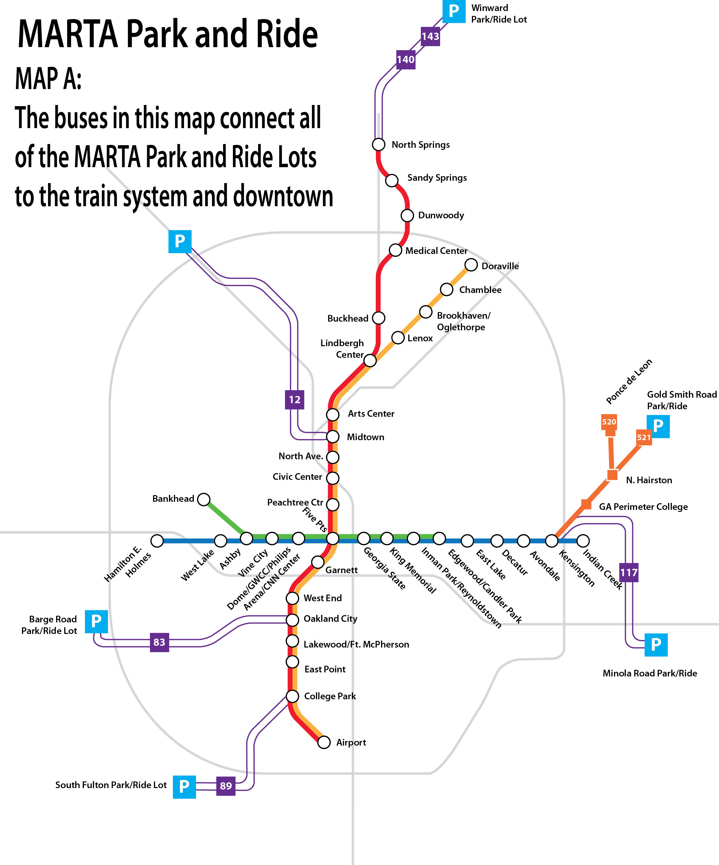
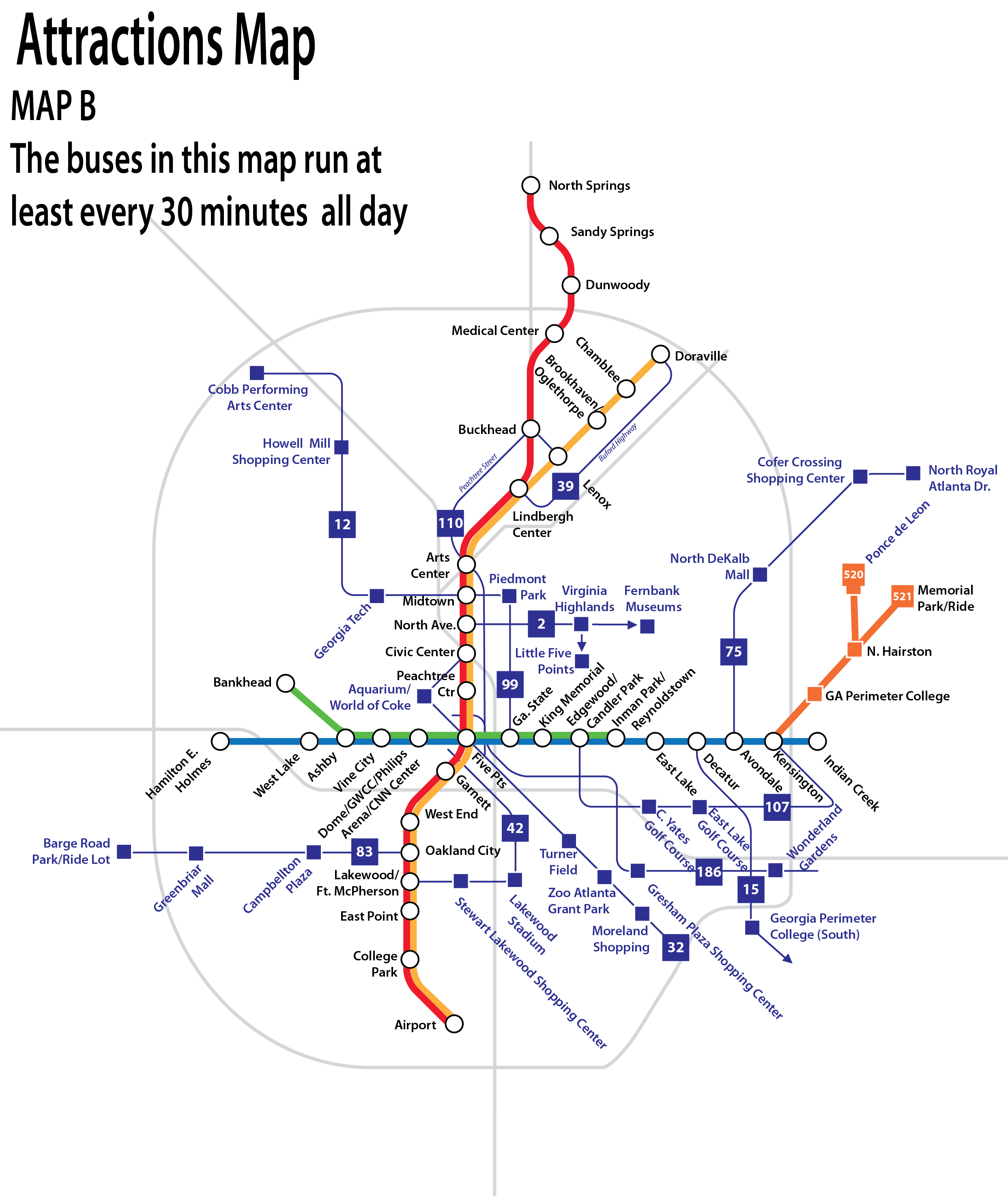
For the last two years I have been working on a mapping project using MARTA as a case study. More and more transit enthusiasts and professionals are calling for maps that either highlight or only show transit routes that are frequent (typically ten minutes or less, sometimes 15 minutes or less). In the Atlanta Region, MARTA has a rail map that includes only its four rail lines and a separate map that shows all 93 bus routes plus various shuttles and is difficult to read and understand. For this project, we created multiple multi-modal maps that include the rail lines as well as bus routes that meet different criteria. One map showed rail lines plus all bus routes that reached park and ride lots, one showed all rail lines plus bus routes that had a headway of 20 minutes or less throughout the entire day, and a map that included the rail lines plus bus routes that reached popular destinations around Fulton and DeKalb Counties. Through surveys of transit riders and non-riders we were able to find that different groups of riders preferred different maps. Frequent riders preferred having frequent bus routes while occasional rides preferred bus routes that reach popular destinations. Additionally, through these surveys, these maps were shown to be particularly effective for increasing the number of bus trips that current riders will take, generating new riders, and increasing the overall understanding of the MARTA bus system. We also found that almost 30% of participants are still planning bus trips using paper maps and schedules. Even as smartphones and applications get smarter, we still need to be producing effective transit maps.
Great idea and they look great. Smart to include buses with short headways on the map, because it exposes potential riders to buses that have a perception of being inconvenient.
Thanks Donny! Also, be on the lookout for MARTA Spider Maps. We are in the process of creating paper Spider Maps for stations and an interactive website!
This is fantastic. I usually use my smart phone/Google maps to to plan bus trips. But when the phone dies (which it sometimes does), these maps would be a great help.